- Home
- Services & Solutions
- Transport (Roads, Rails, Air, Oceans)
- POLARIS - The Ocean Data Service for the Maritime Industry –
Services & Solutions
POLARIS - The Ocean Data Service for the Maritime Industry –
Realise 「Valuable Vessels」 with meteorological and oceanographic data.
Meteorological and oceanographic data is a necessity and used in a wide range of fields: such as the assessment of efficient ship operation and its design, safe and energy saving voyage (reducing CO2 emissions), verification and assessment after voyage, and working with DX.
We support these fields with our POLARIS services.
For this new business in the maritime cluster, we also provide data by Web API.
POLARIS provides various types of data to suit your specific needs.
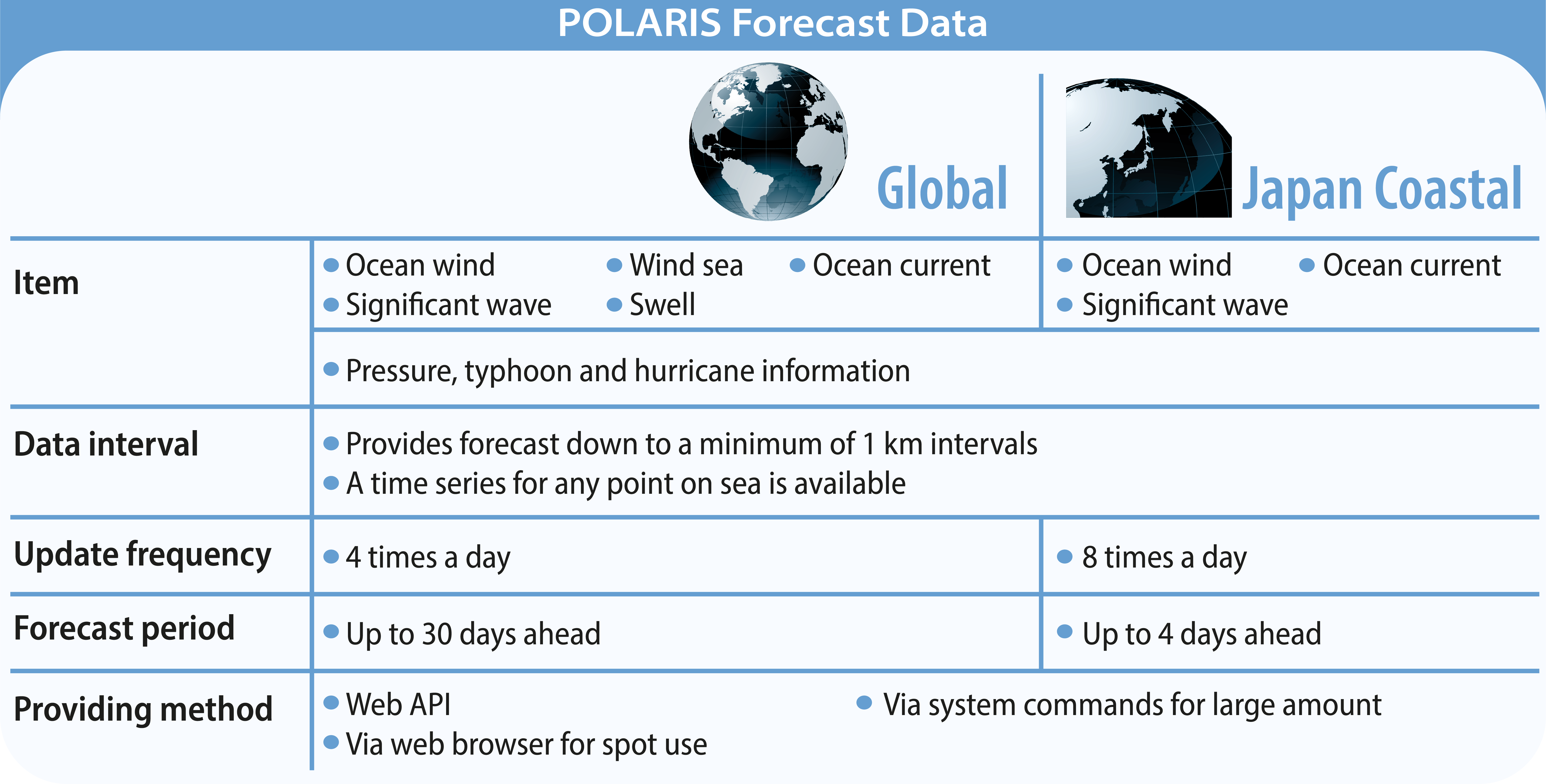
POLARIS Forecast
POLARIS Forecast provides weather and ocean forecast data.
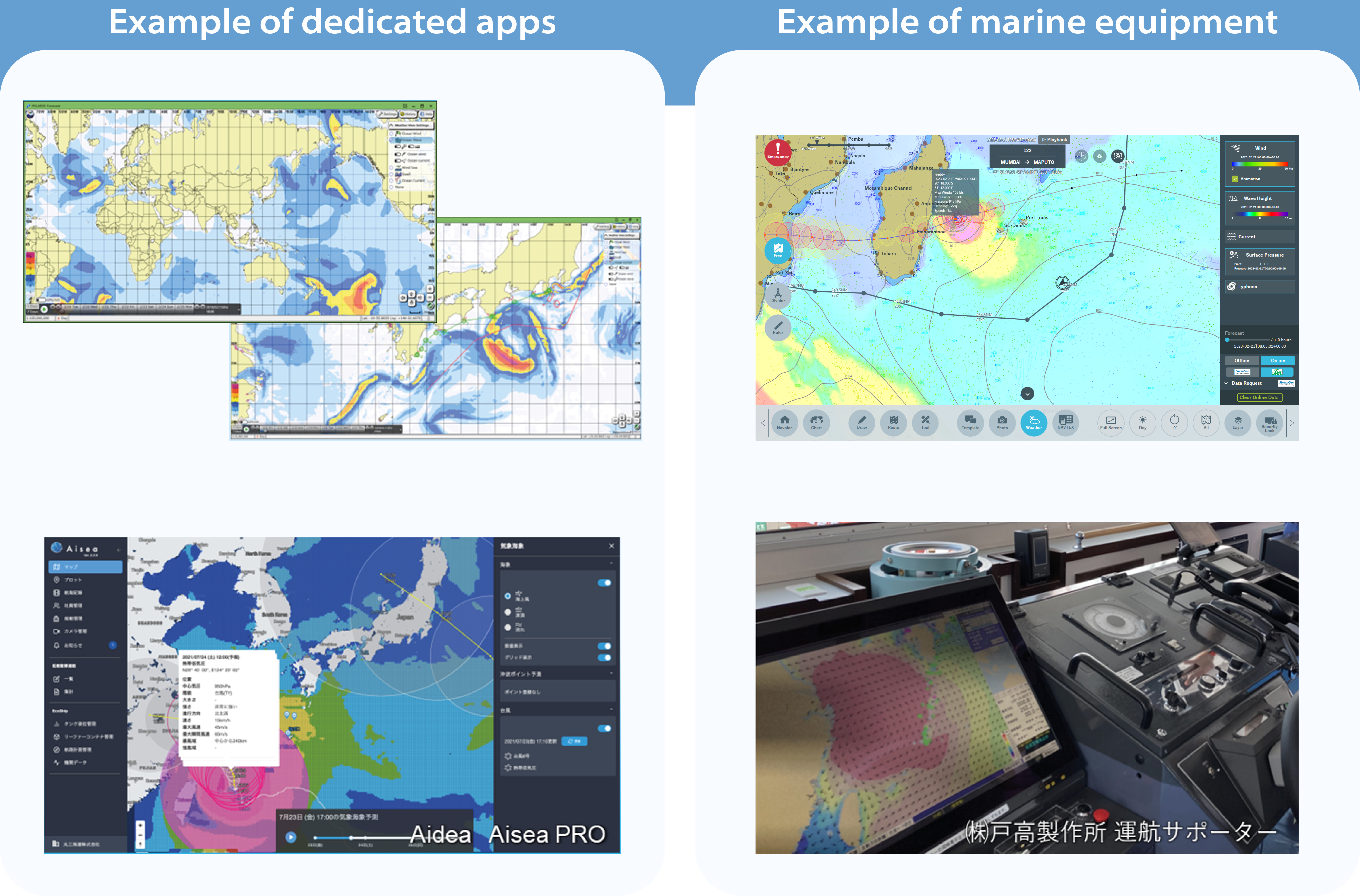
The forecasts can be viewed on our dedicated app. The data can also be displayed directly on to the marine equipment, as they can be easily linked to the system.
⇒ Use case of POLARIS Forecast
Return to the top of this page
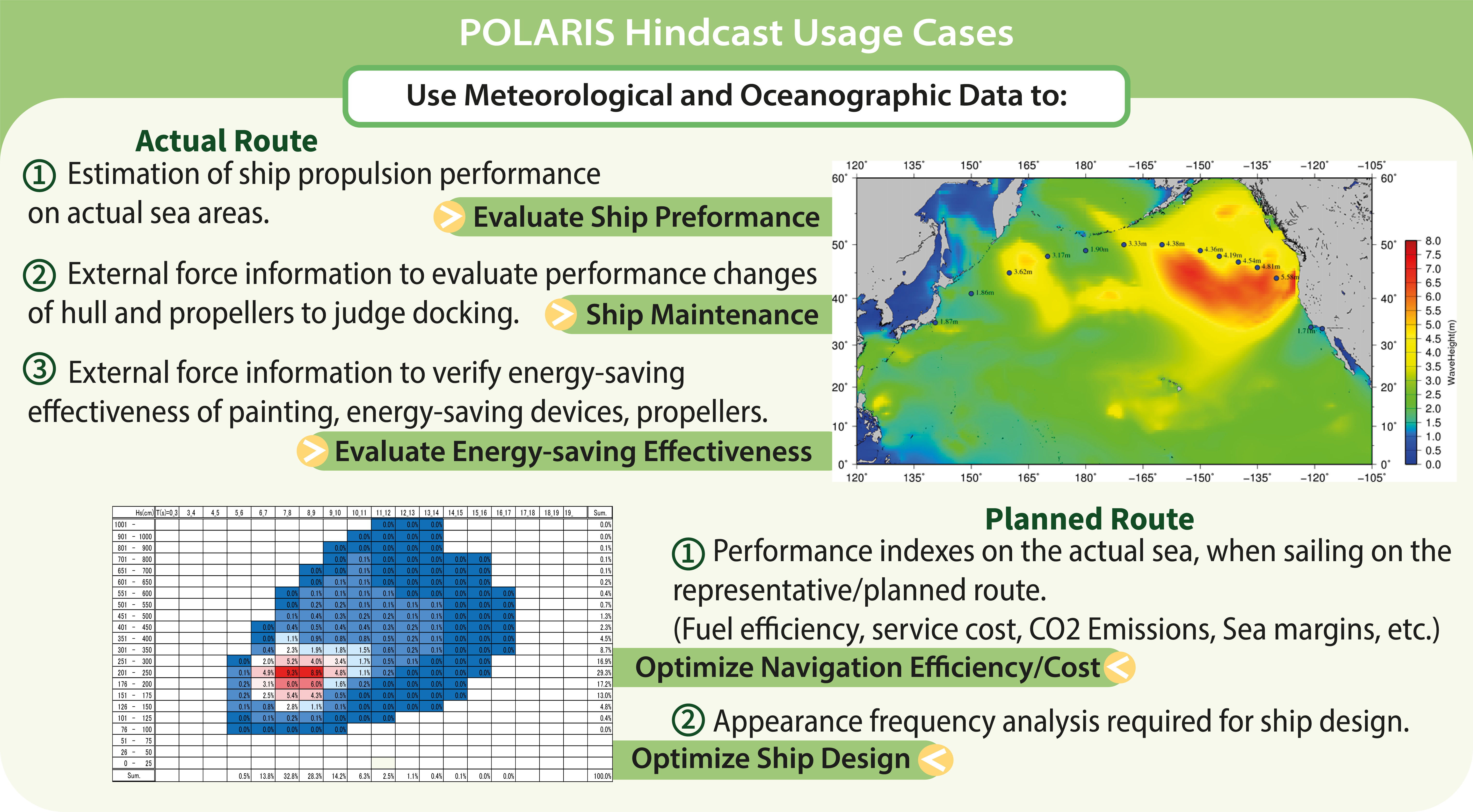
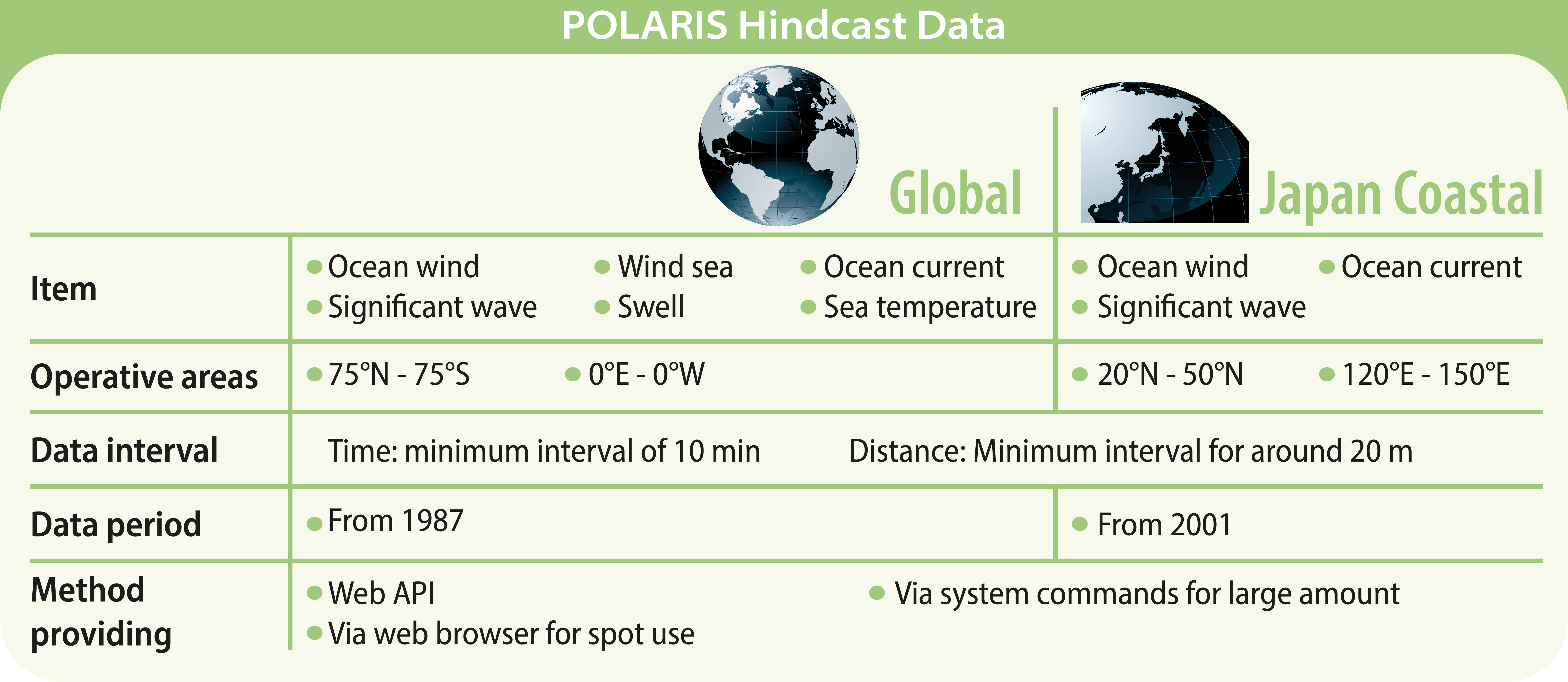
POLARIS Hindcast
POLARIS Hindcast provides various kinds of weather and ocean data via web API. This global data library can be accessed at any location, at any date and time, and is guaranteed to be reliable and highly accurate.
When we refer to global historical data, observational data might be the first to come in mind, though this is not correct. Observational data is collected from satellites and buoys and is accurate, but the problem is that the spatial and temporal densities are low. Hindcast data are global estimates, and their accuracy has been verified using various observed values. Therefore, it will give you the most probable weather and sea conditions at any point.
We have provided this database for over 50 years, using our wave estimation technology and accumulated knowledge.
⇒ Use case of POLARIS Hindcast
Return to the top of this page
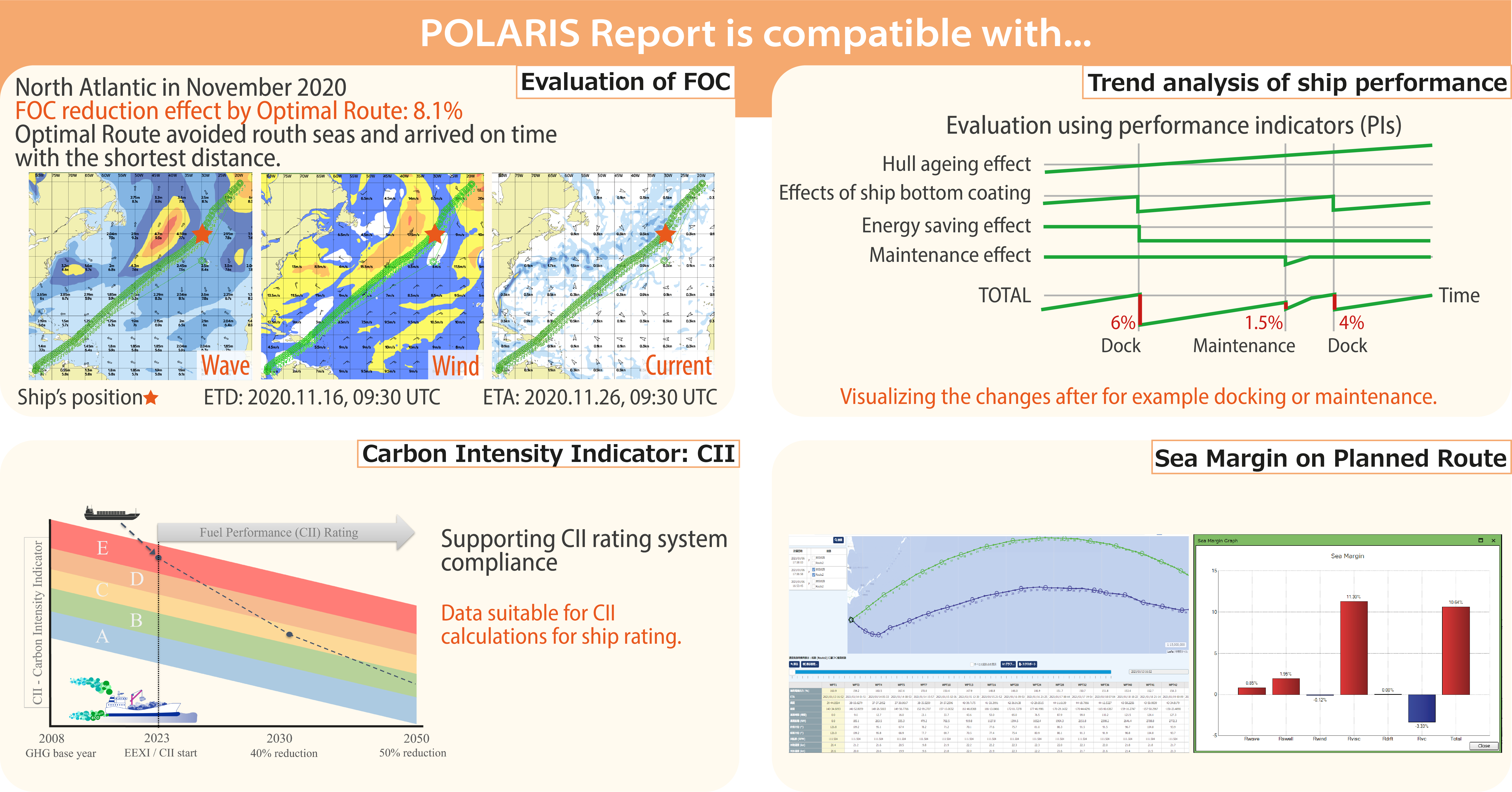
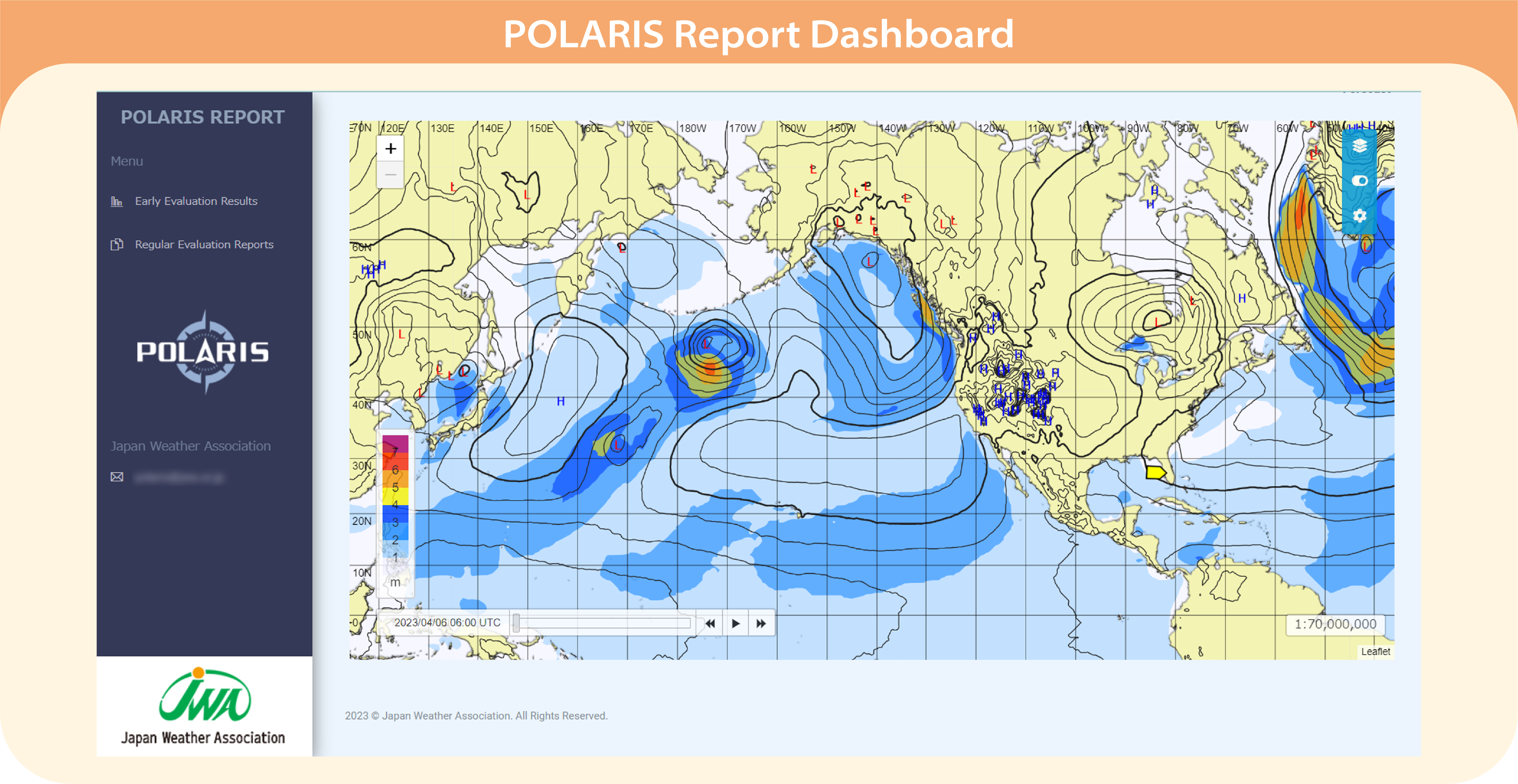
POLARIS Report
POLARIS Report is the service for ship assessment and analysis, using actual voyage data and historical ocean data for calculations.
We use our POLARIS Hindcast data for our analyses, as this data gives us a highly accurate understanding of the weather conditions during the time of the actual voyage.
Of course, the weather and ocean forecasts (POLARIS Forecast) are already integrated into the dashboard.
⇒ Overview of POLARIS Report
⇒ CII Rating and Ship Assessment
Return to the top of this page
More about POLARIS …
Use Cases
Kawasaki Kinkai Kisen Kaisha, Ltd.
Usufuku Honten Co. Ltd.
Contact an expert for this service.

Services & Solutions Services & Solutions
-
Electric Power Demand Forecast
-

Solar Power Generation
-

Wind Power Generation
-

Environmental Impact Assessments
-

Disaster Mitigation・Crisis Management・Climate Change Measurements
-

Transport (Roads, Rails, Air, Oceans)
-
Meteorological and Oceanographic Forecasts & Real-Time Data Provisioning
-

Manufacturing, Retail, Advertising, and Marketing
-

tenki.jp & Media Services
-
Web, Apps and Other Services